The Wetland Was Here: Why Timing Changes What We Can See
Wetlands are not always “wet” when you happen to visit them. They are dynamic systems shaped by snowmelt, rainfall, groundwater, soil characteristics, vegetation, and site position. Some hold water for long periods, while others only show themselves clearly for a short window each year.
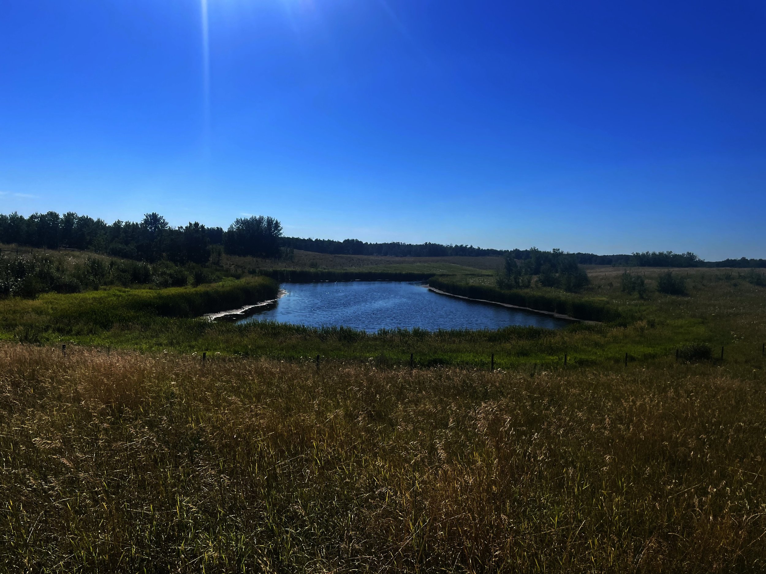
That is why timing is a consideration during any site visit. In May, a low spot in a project area may be full of water. By August, that same area may be dry enough to walk across in regular boots. Same site, different season, very different evidence. A wetland assessment is not just about whether there is water on site that day. It is about understanding how water moves through the area over time.
Spring showers bring summer flowers
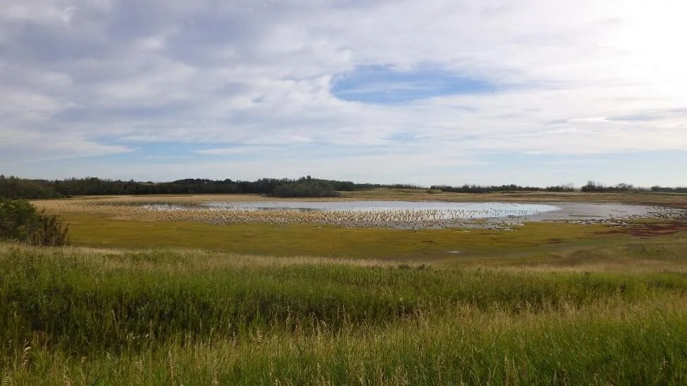
Even when surface water disappears, wetlands leave evidence behind. In spring, those clues are usually easier to see because of higher potential water inputs. Snowmelt and early-season rainfall can reveal where water collects, moves, and persists long enough to influence soils, vegetation, and wetland class.
This is especially important for ephemeral, temporary, and seasonal wetlands, which may only hold visible surface water for part of the year. In spring, ponding, saturated soils, and surface water connectivity or drainage can help show whether a feature is isolated, connected to other wetlands or aquatic systems, or responding to broader site hydrology.
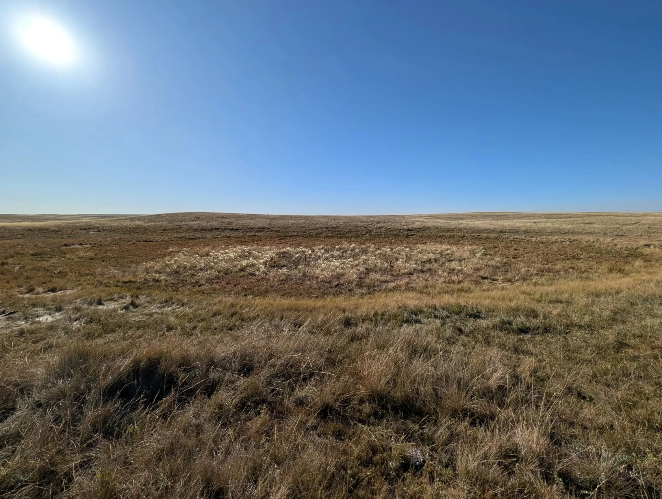
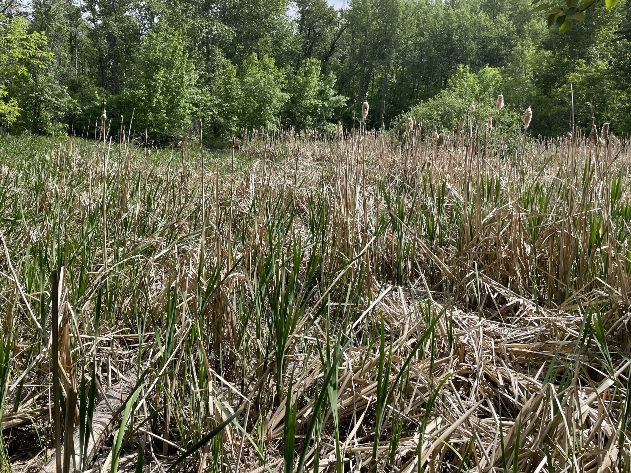
By late summer, above ground clues are a little more nuanced. Water levels may drop, or completely dry up, and surface saturation may no longer be evident. A feature that looked unmistakably wet in May may look like an ordinary depression in August.
That does not mean the wetland disappeared. It means you might have to dig a little deeper for evidence.
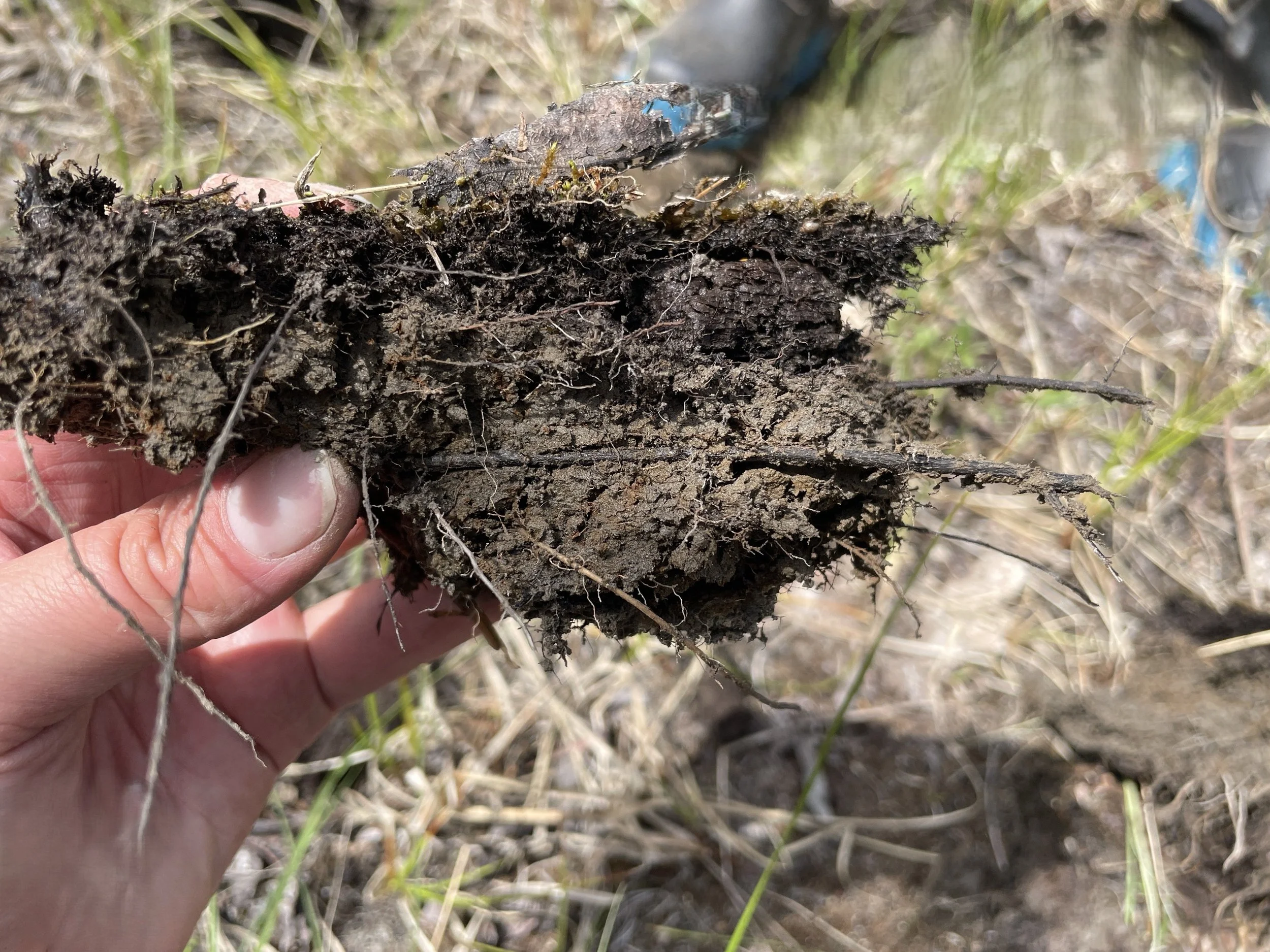
Spring may be a convenient time to conduct wetland assessments regarding visible saturation; however, mid-summer field work has some advantages. Vegetation identification is ideal once plants are more established, later in the growing season. A plant species’ tolerance for saturated soils can provide valuable insight on soil water content throughout the season. Additional evidence can be found below ground where key soil characteristics act as wetland indicators. Therefore, wetland assessments require a combined analysis of above and belowground characteristics.
Delineation is more than drawing a line
A wetland delineation is the process of identifying the ecological boundary between wetland and upland areas. In practical terms, it helps determine where the wetland starts and stops, dictating what portion of a project footprint may be affected, and what regulatory considerations may apply.
That boundary is not based on a single observation or whether there happens to be standing water on the day of the assessment. A defensible delineation considers multiple lines of evidence, including hydrology, hydric soils, hydrophytic vegetation, terrain position, drainage patterns, historical imagery, and associated weather patterns.
In Alberta, the Wetland Identification and Delineation Directive provides standardized methods for identifying wetlands, delineating their ecological extent, and supporting spatial submissions under the Alberta Wetland Policy and Water Act process. In British Columbia, wetland considerations may arise under several regulatory frameworks, including the Water Sustainability Act where proposed works affect streams or aquatic environments. In Saskatchewan, wetland and drainage considerations are closely tied to the Water Security Agency’s drainage approval process, including wetland retention and water management requirements for agricultural drainage.
Wetland delineations begin with a desktop review of historical aerial imagery and precipitation data, to outline an expected wetland boundary considering variability within the wetland in wet, dry or average years. The next step involves field verification, where the wetland class and boundary are confirmed. Field sampling involves determining the presence or absence of hydrophytic vegetation, hydric soil, and wetland hydrology. Desktop delineations and initial field observations guide sampling locations which are used to refine the upland and wetland boundary and determine wetland class.
Regardless of the season, assessments require an interpretation of soil indicators, vegetation, topography, historical imagery, climate conditions, and professional judgment to understand how the site functions during wet, dry, and normal periods.
Standardized protocols used to assess wetlands help to reduce uncertainty around wetland boundaries, the potential for negative impacts, and the supporting rationale provided to regulators.
The best evidence considers seasonality
A wetland assessment is not just a snapshot of the site on the day someone walks it. It is an interpretation of evidence through the seasons.
A wet year and a dry year may make the same area look very different. A spring versus a late-summer visit may reveal different parts of the same system. Effective wetland assessments bring those pieces together and asks much more than, “Is there water here today?”
The better question is: what does the site tell us about how water behaves here over time?
That is why professional judgement and experience matters. If your project area includes low-lying ground, drainage features, spring ponding, saturated soils, or areas that seem to change dramatically between May and August, the most obvious evidence may only be visible for a short part of the field season.
Wetlands do not always announce themselves loudly. However, they leave clues for a trained eye. Our job is to read those clues, even when they’re quietly blending back into the surrounding terrain as the season wanes.