
Digging into Dirt (and Data): A Regulatory Adventure
Curious about what happens when someone wants to access natural resources on their property—like digging a giant hole in the ground? That’s where we (AJM’s environmental experts) come in, armed with boots, binoculars, and laptops. In this article, we’ll walk you through a real-life project example where we conducted a Biophysical Impact Assessment (BIA) for a landowner with a claypit mine on agricultural land in Alberta. Keep reading to learn how we approach these assessments and what they involve!
First Things First: What’s a BIA Anyway?
A BIA is like a risk assessment, for the environment. We scoped out potential adverse effects, suggested ways to mitigate possible negative impacts, and determined whether any effects might remain even after our best efforts. It’s about protecting what matters — or as we call them, Valued Ecosystem Components (VECs). The principal VEC identified was a surface water feature, which instigated the full BIA experience — meaning desktop review, boots-on-the-ground surveys and a full write-up as per the County’s regulatory requirements.
Desktop vs. Field: A Tale of Two Methods
We started at the computer (comfy, warm, coffee nearby), reviewing aerial imagery, geospatial datasets, and historical info. Once we knew where to focus our efforts we packed up and hit the field (snow or shine!). It was a classic detective story: the computer gave us clues, and the field confirmed or debunked them.
What Did We Investigate? Eight fabulous VECs:
Designated Areas – Think protected zones, biodiversity hotspots, and places where critters like to take a break during migration. We conducted a desktop review using a compilation of spatial datasets in a Geographic Information System (GIS) to determine whether any designated areas were present on or near the project.
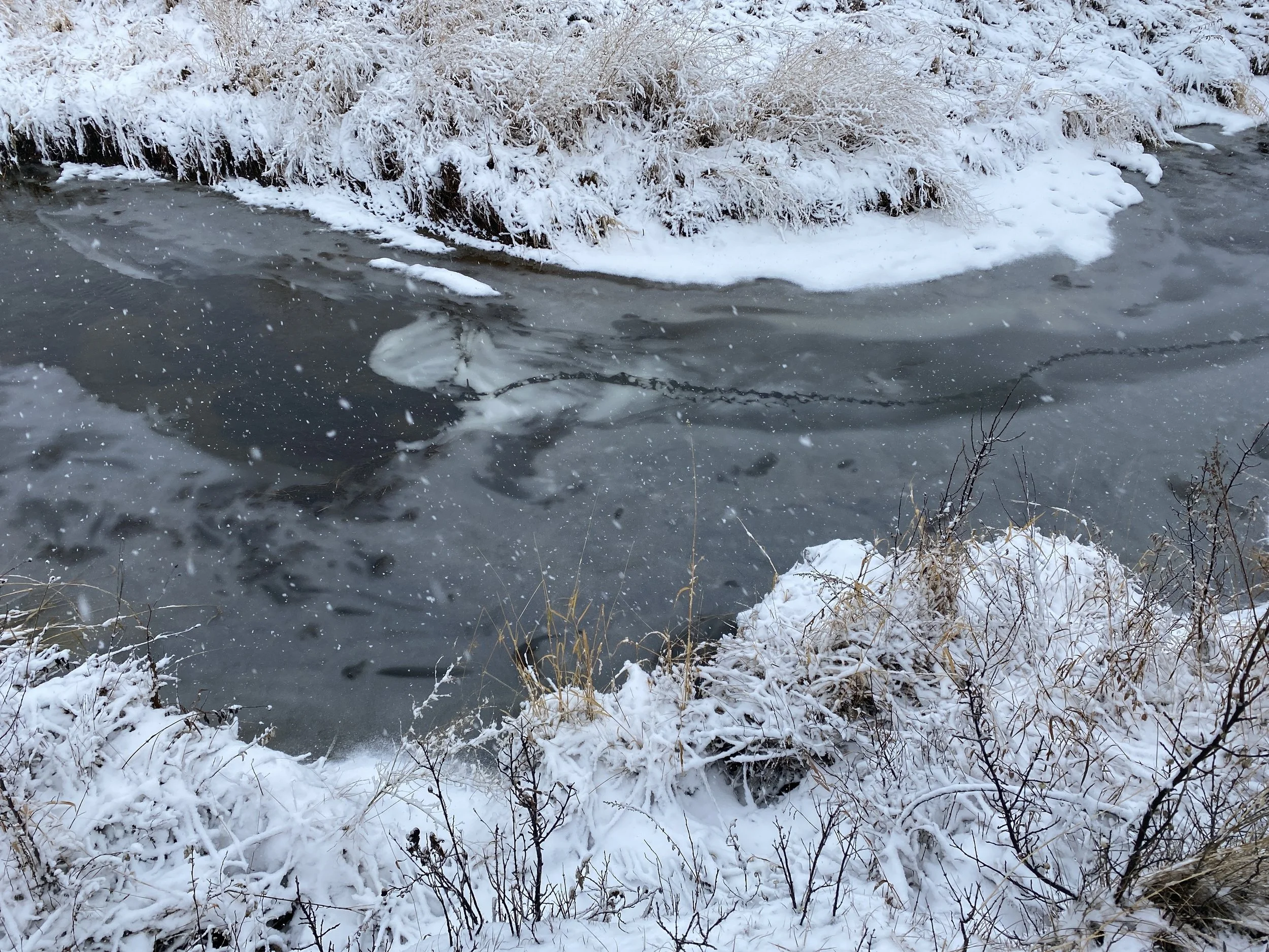
Fish & Fish Habitat – A fish bearing stream got a hard look. Especially since streams are dynamic systems that can experience impacts beyond the scope of a project! First, we looked at historical datasets and discovered the nearby watercourse had previously recorded fish presence. Then, a field survey was conducted by a Qualified Aquatics Environmental Specialist to assess channel and near-shore characteristics, confirm bank form and function, observe current aquatic conditions (e.g., substrate types and water/ice depths) and collect aerial imagery/videography specific to the watercourse.
Land Use & Land Cover – We asked ourselves - what have humans been up to around here, past and present? Was there any agricultural, industrial, residential and recreational use? Historical land use and land cover for the property was determined using aerial imagery from as far back as the 80’s! Whereas current land use and cover was determined during the field survey and through communications with the landowner.
Plant Species & Communities – Who’s growing where and why? With our boots on the ground, we identified vegetation to the species level. Once we determined the dominant species in the different areas, plant communities were assigned according to the natural region and subregion, soil type, and land use associated with each area. In short, we caught up on all the plant gossip from the neighborhood!
Soils & Terrain – We got our hands dirty, literally. We classified soils using historical data and followed up with hand texturing to determine the proportions of sand, silt and clay in each of the soil horizons. Through assigning a soil colour, we were able to estimate levels of organic matter and other minerals within the soil profile. We also recorded changes to the structure of the terrain, such as steep excavations that might impact other VECs including accessibility for wildlife or habitat availability.
Wetlands – We scoured GIS databases for watery wonderlands, then confirmed our suspicions in the field by looking for signs of perennially or seasonally wetted areas and their associated aquatic vegetation.
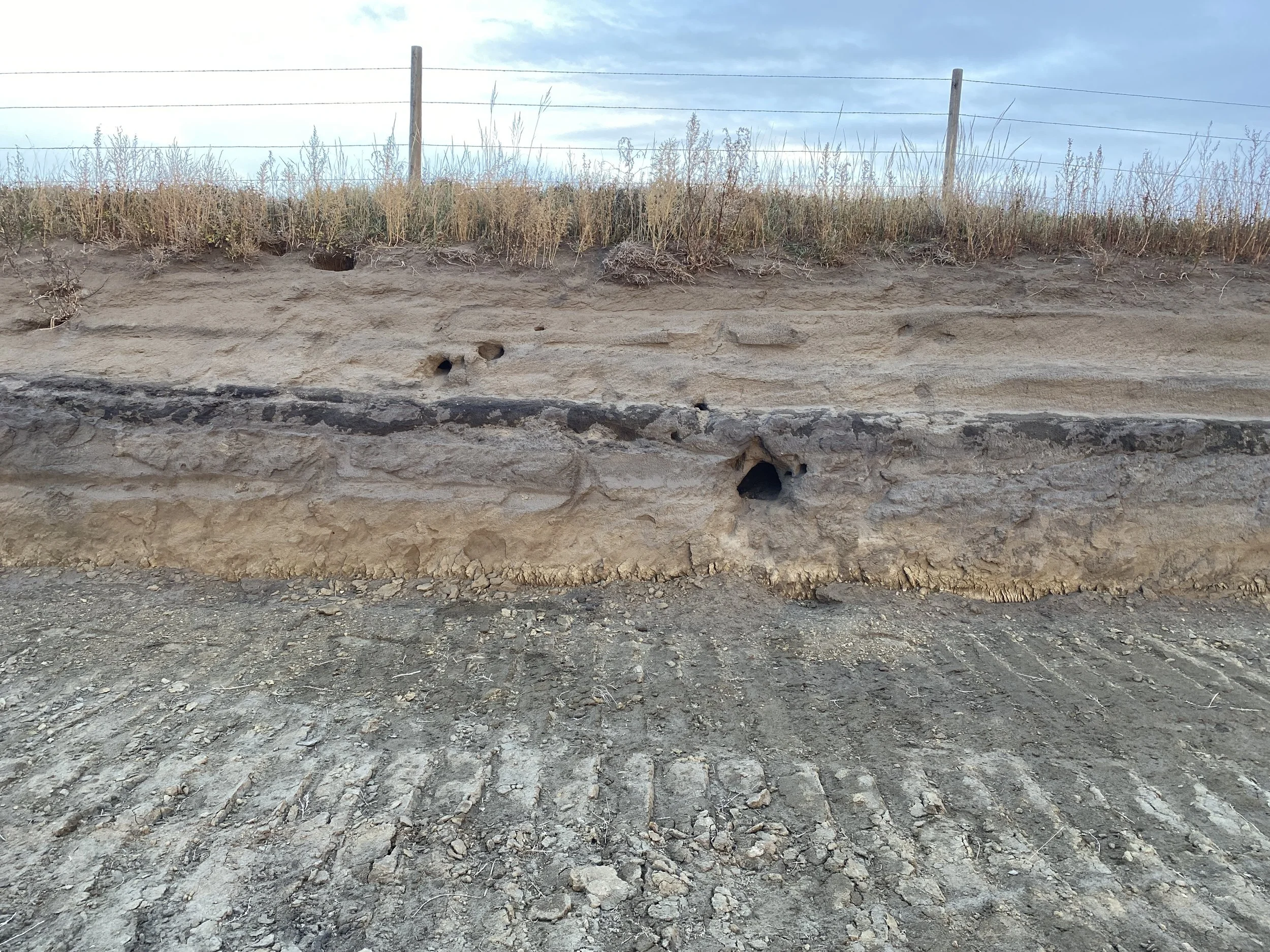
Wildlife & Wildlife Habitat – Tracks, nests, or shady spots animals might love — we looked for it all. Our field survey included a search for potential or observed animal presence and habitat suitability. Basically, a wildlife Airbnb check.
Species at Risk – Endangered, threatened, or sensitive, we made sure no vulnerable species were left out. Our desktop review included searching provincial and federal databases for species at risk, plants and animals alike! The field survey included a search for evidence of species at risk, including tracks and burrows.
Risks & Real Talk
We identified a few potential impacts such as sediment escaping into fish-bearing streams. In collaboration with the landowner, we proposed mitigation strategies including erosion control measures and distancing activities from the watercourse. Another potential impact was the creation of desirable bird nesting habitat through excavation. Our recommendations included reducing the slope of excavated areas and establishing a 50 m buffer around active nesting sites.
The Wrap-Up!
In the end, the landowner and county received a clear, regulatory-compliant report, and us? We got another excuse to “dig up the dirt” for a local landowner. Win-win-win. Next steps include review and implementation of the mitigation measures followed by monitoring to assess the effectiveness of controls. Once these mitigations are put in place, the potential impacts to the environment are anticipated to be minimal.
Written By: Katie Philp, AJM Environmental Vegetation Ecologist