Bathymetry: The Shape of Sound
Have you ever wondered what the bottom of the ocean looks like? Or how deep your favourite lake is? Using the science of bathymetry, we can investigate these mysterious biomes without ever leaving the surface!
What is Bathymetry?
Bathymetry is the measurement of water depth in river, lake, and ocean ecosystems. It is a fundamental component of hydrography which studies the physical characteristics of a water body. Historically, bathymetry was used to develop nautical maps to support safe maritime navigation. Scientists would manually measure water depth using weighted rope or cable and plot the data to create 2D contour maps. While this technique was novel for the time, it was dangerous, time-consuming, and had a large margin for error. Technological advancements since then have vastly improved the safety and accuracy of bathymetric surveying.
Modern Bathymetry
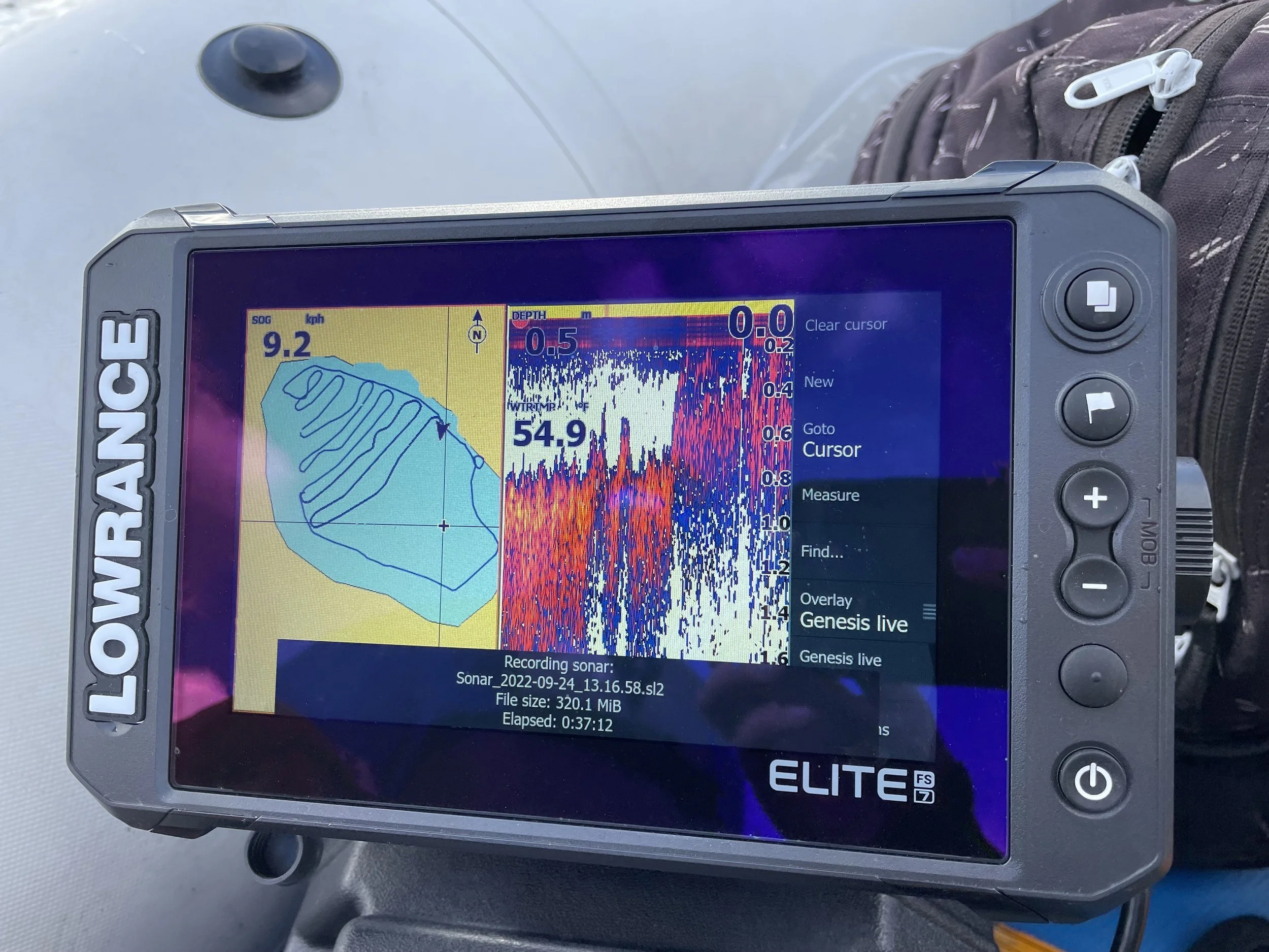
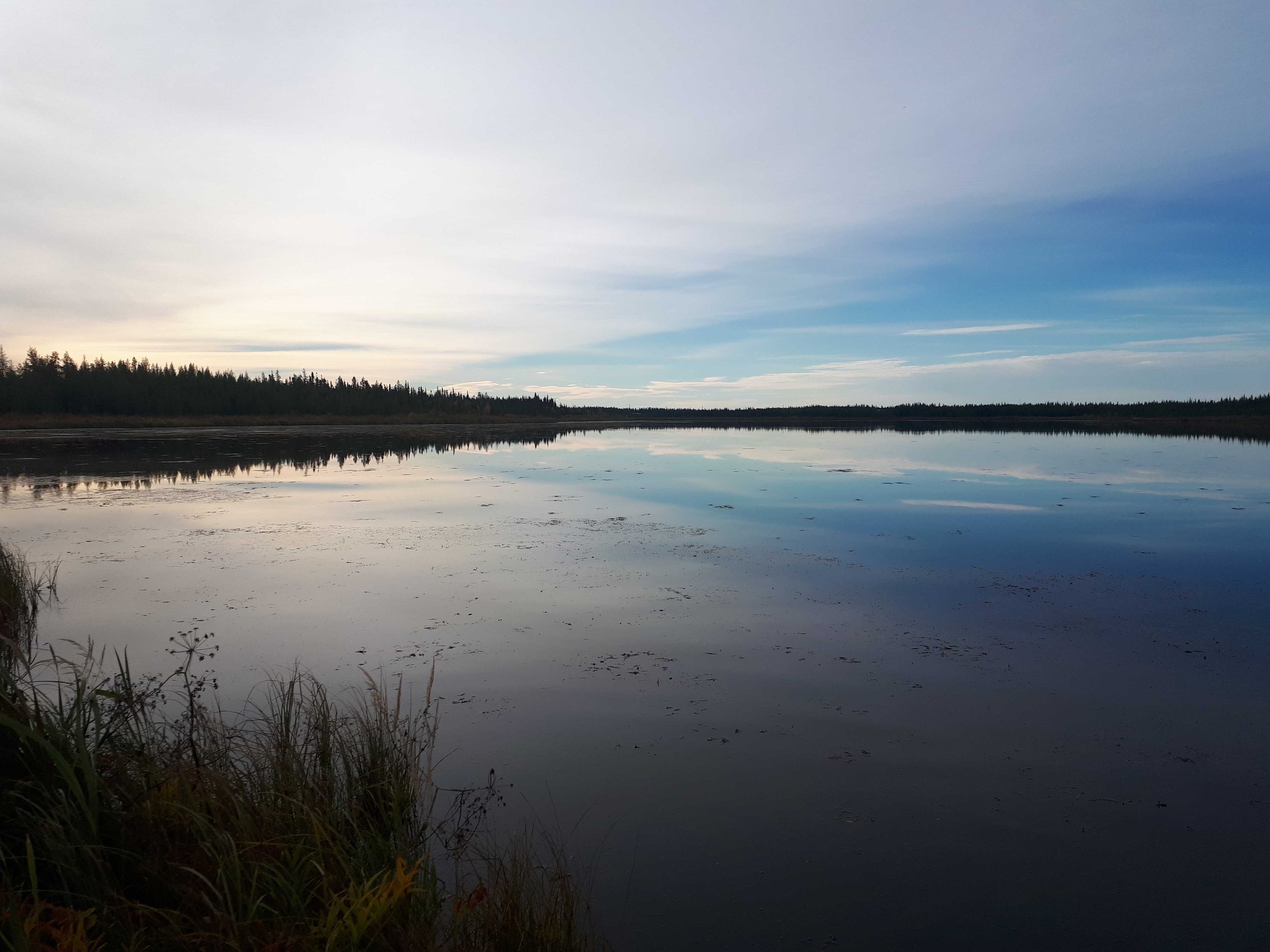
Photo by: Brittany Claeys
Modern bathymetry uses echolocation, also known as sonar or “sound navigation and ranging”, to determine the distance between objects. A device called a transducer emits a sound signal into the water that reflects off surfaces, substrate, and submerged structures. Distance to the object is calculated by comparing the signal’s return time to the speed of sound. Different sound frequencies are used depending on the desired survey depth. High frequencies produce high resolution data but are limited to relatively shallow depths. Low frequencies reach much deeper depths but produce lower resolution data (NOAA, Acoustic Doppler Current Profiler). Regardless of frequency, however, sonar scanning produces an accurate terrain profile which can then be used to produce a 3D model of the underwater world!
While bathymetry came from navigation roots, it is now applied in a variety of ways including monitoring riparian erosion. By regularly measuring the location and depth of shorelines, the spatiotemporal effects of erosion processes can be closely monitored. This is an important consideration when planning development projects near rivers and reservoirs. Bathymetry is also a valuable tool for modelling flood zone risk by calculating the water storage capacity of a waterbody. It can also be used to map flood water levels after natural disasters (USGS, 2016 July 13).
Technological Advancements
The methods and technologies for collecting bathymetric data have developed significantly over the years. Humans no longer have to brave harsh environments to conduct surveys as Autonomous Underwater Vehicles (AUV) can collect data for us (USGS, 2016 July 12). These drones are remotely controlled or have pre-programmed navigation and can travel in both shallow and deep environments. AUVs have an internal power supply and are outfitted with both bathymetric scanners and water quality sensors (NOAA, What is an AUV?). Additionally, multiple drones can be deployed at the same time allowing for a more robust and expansive survey.
Sonar can also be used to survey substrate conditions beneath a waterbody. This requires a specialized device called a sub-bottom profiler which emits a sound signal that travels through the waterbody floor into the underlying substrate layers (USGS, 2016 July 13). Each layer will have a unique density which will cause the signal to return to the transducer at a different time. The time it takes for the signal to return is then used to approximate each layer’s thickness (Geoscience Australia, n.d.).
Field Application
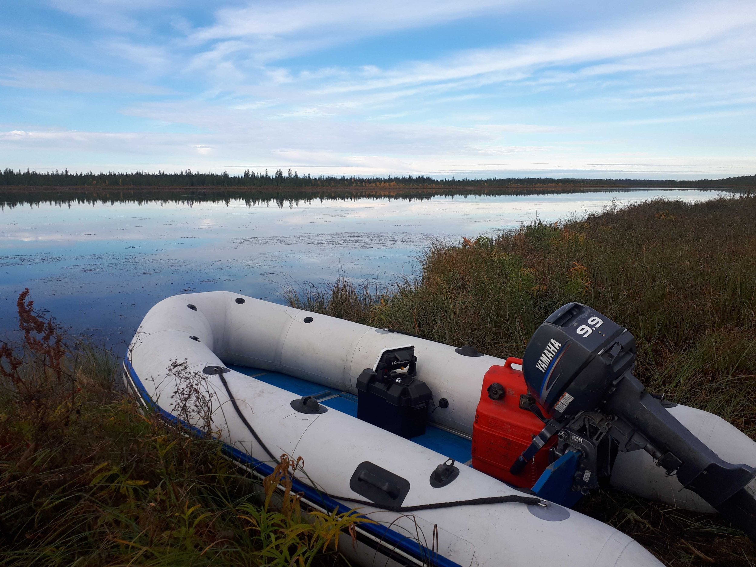
Bathymetric surveying can be as simple or complex as required for your project. In this photo, AJM Environmental Scientist, Brittany Claeys, is using a Lowrance echolocator to analyze the underwater profile of a lake in Alberta. Water depth readings were recorded every five seconds along transects, as well as latitude and longitude coordinates. This bathymetric data was uploaded into QGIS software and analyzed using the triangular
irregular network (TIN) function and used to create a detailed contour map of the lake’s submerged terrain.
Despite the threats, there are many ways to manage and mitigate risks for this species. Resource specialists, like those at AJM, have experience working with provincial species management best practices to help guide recreational and industrial projects that may affect sensitive species, including the long-toed salamander. In the provinces of British Columbia, Alberta, and Saskatchewan, the provincial Wildlife Act protects wildlife from impacts that might result from human activities, including construction projects. Proponents are required to implement effective measures to avoid or mitigate impacts. Site isolation and/or amphibian salvage and relocation are examples of avoidance/mitigation measures used for projects where detrimental effects to amphibian species may occur.
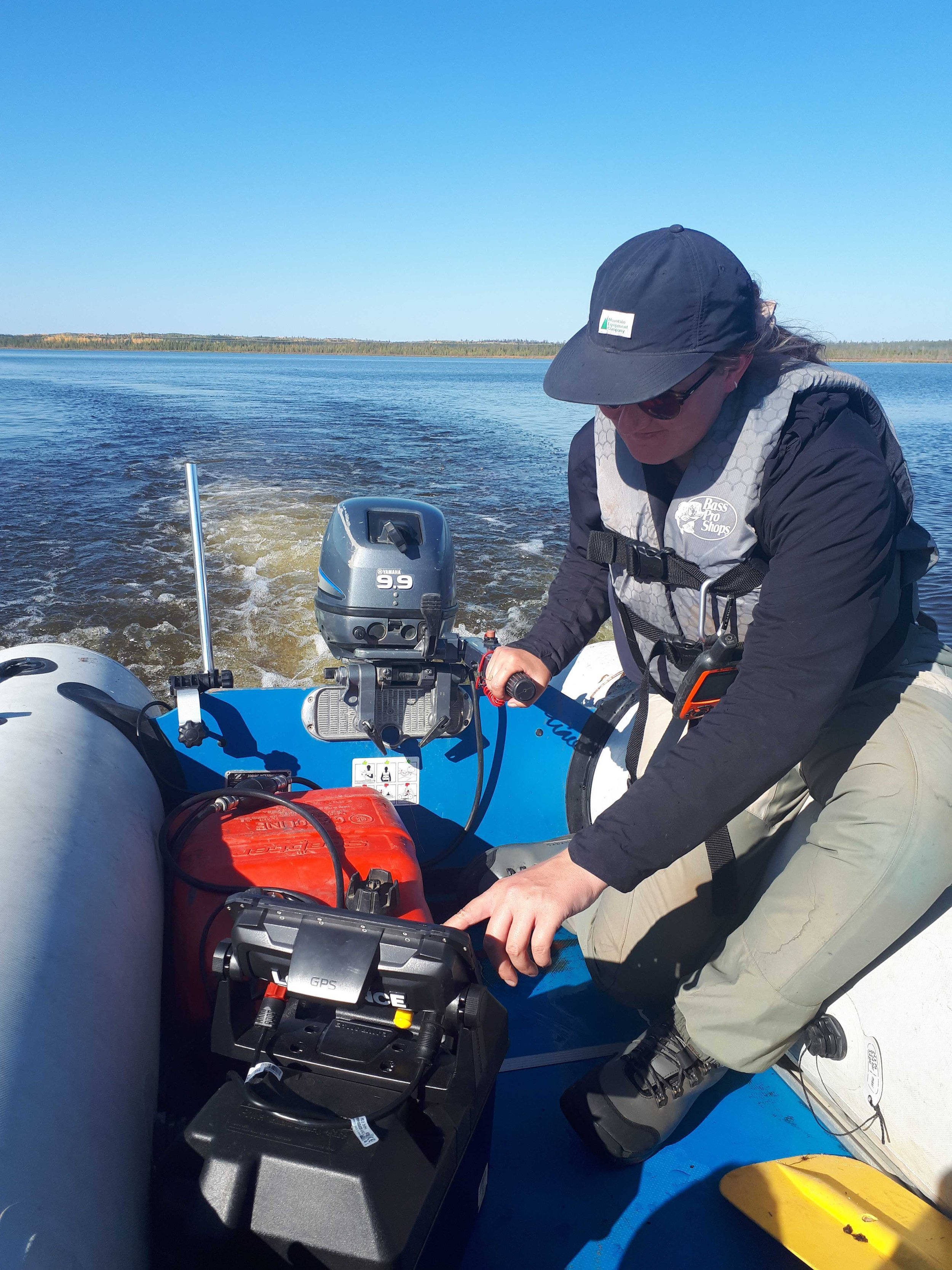
Photo by: Jarrett Porteous
AJM has and continues to support construction activities that occur within known amphibian ranges or in proximity to amphibian habitat.
Our support to these projects consists of the planning and/or application of appropriate environmental mitigations, including the implementation of barriers to project sites, and salvage and relocation of amphibians away from project activities. This past summer alone, the AJM field crews helped protect thousands of salamanders, as well as frogs and toads, by relocating them out of harms way during pipeline construction!
An effective amphibian mitigation and salvage plan will:
By: Jarrett Porteous, BSc., AJM Environmental Scientist